Hurricane Helene’s damaging wind may extend well inland in Florida
PHOENIX (AZFamily) — Hurricane Helene is forecast to make landfall late Thursday around the Big Bend area of Florida as a Category 3 hurricane. However, there is a chance that the storm could be even stronger as the National Hurricane Center notes, “...upward adjustments to the forecast intensity could be required...”
Rainfall flooding and storm surge flooding are major threats from this storm, but damaging winds will also likely play a big role.
The current forecast from the National Hurricane Center keeps Helene as a hurricane for a while after landfall as she travels north into Florida and then Georgia or Alabama.
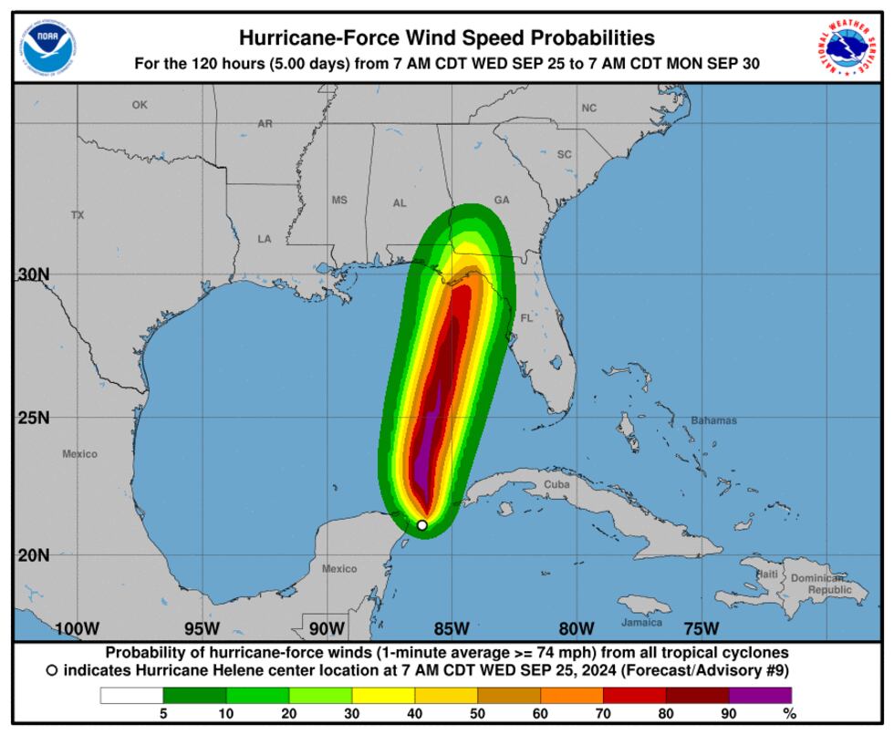
The map below shows the probability of hurricane forecast winds. By definition, hurricane forecast winds are sustained winds of at least 74 mph. That is certainly enough to cause damage and power outages.
Storm surge flooding is a huge threat, with 10 to 15 feet possible near Florida’s Big Bend and 5 to 8 feet possible in the Tampa area.
Rainfall flooding will also be widespread, especially in parts of Florida, North Carolina, South Carolina, Georgia, Alabama, and Tennessee.
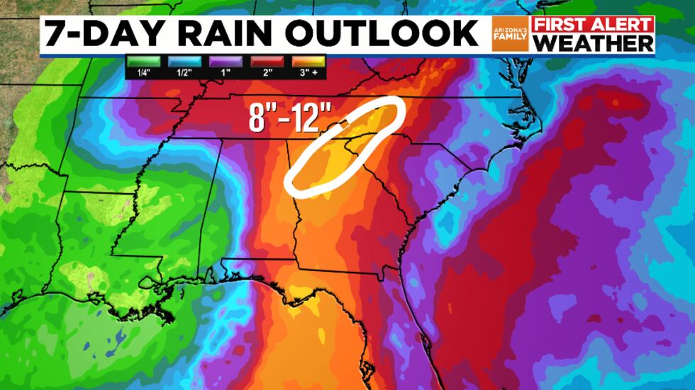
The Atlanta metro area could be in that 8″ to 12″ rainfall zone, which could cause big problems considering the large population. Stay tuned for updates!
See a spelling or grammatical error in our story? Please click here to report it.
Do you have a photo or video of a breaking news story? Send it to us here with a brief description.
Copyright 2024 KTVK/KPHO. All rights reserved.